‘I don’t know where to start.’ Is my diary entry after my first day in the Bolivian Altiplano. It went on: ‘Laguna Blanca, Laguna Verde, Laguna Colorado, The Dali Desert, The Stone Tree, fumaroles. Driving across desert on non-existent roads, plumes of dust behind us. Wildlife everywhere, when you know where to look’.
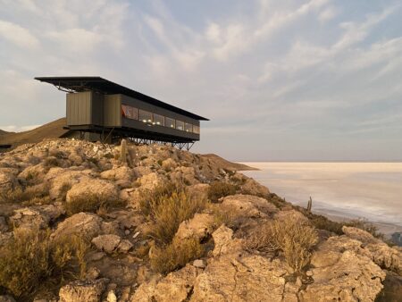
The Atacama Desert was the other major area of Chile that I had not managed to visit whilst we lived there. My daughter had visited it on her gap year and insisted that I had to go. Then several years ago a travel article described an 11 day journey exploring the Atacama Desert and traversia through the altiplano to the Uyuni Salt Flats with a guide and driver. Accommodation was in converted shipping containers. It sounded amazing.
Volcanoes
As the time got closer I thought it might be fun to try and climb a volcano in Chile, so I prepared as best I could, including getting specialised travel insurance for the altitude. Whilst in San Pedro de Atacama I met up with a friend I’d not seen in 30 years – someone who had settled in San Pedro to climb volcanoes. He suggested that on the Bolivian part of the trip that there were two other volcanoes worth climbing. So that completed the plan. The guides and drivers (different on each side of the border) were delighted to have an adventurous client.
My reading material for this part of the journey was Mountains of Fire by Clive Oppenheimer. This was a perfect backdrop to the trip and helping me start to understand different volcanoes and a bit about geology. I did a year of geology at University as part of my forestry degree, but all that stuck was a recollection of geological epochs and rock types and things happening billions of years ago. It was about as valuable as history classes at school, and provided little background to explain much of the geology on the trip.
Understanding the Geology
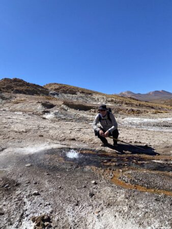
In Chile we visited the Tatio Geysers which is a popular destination. However, this was only the starting point of our day. We hiked away from the geysers and along a wetland system for several hours seeing no-one – only guanaco that allowed us to get quite close. We were at over 4300m and whilst it was sunny, the temperature was below freezing. At one point we came to a place where there were multiple upwellings of water coming out of the ground. Some were cold and quickly formed ice, whilst others, just metres away, were boiling water bubbling out of the ground, steam rising in the cold air. Such contrasts so close. What is happening underground?
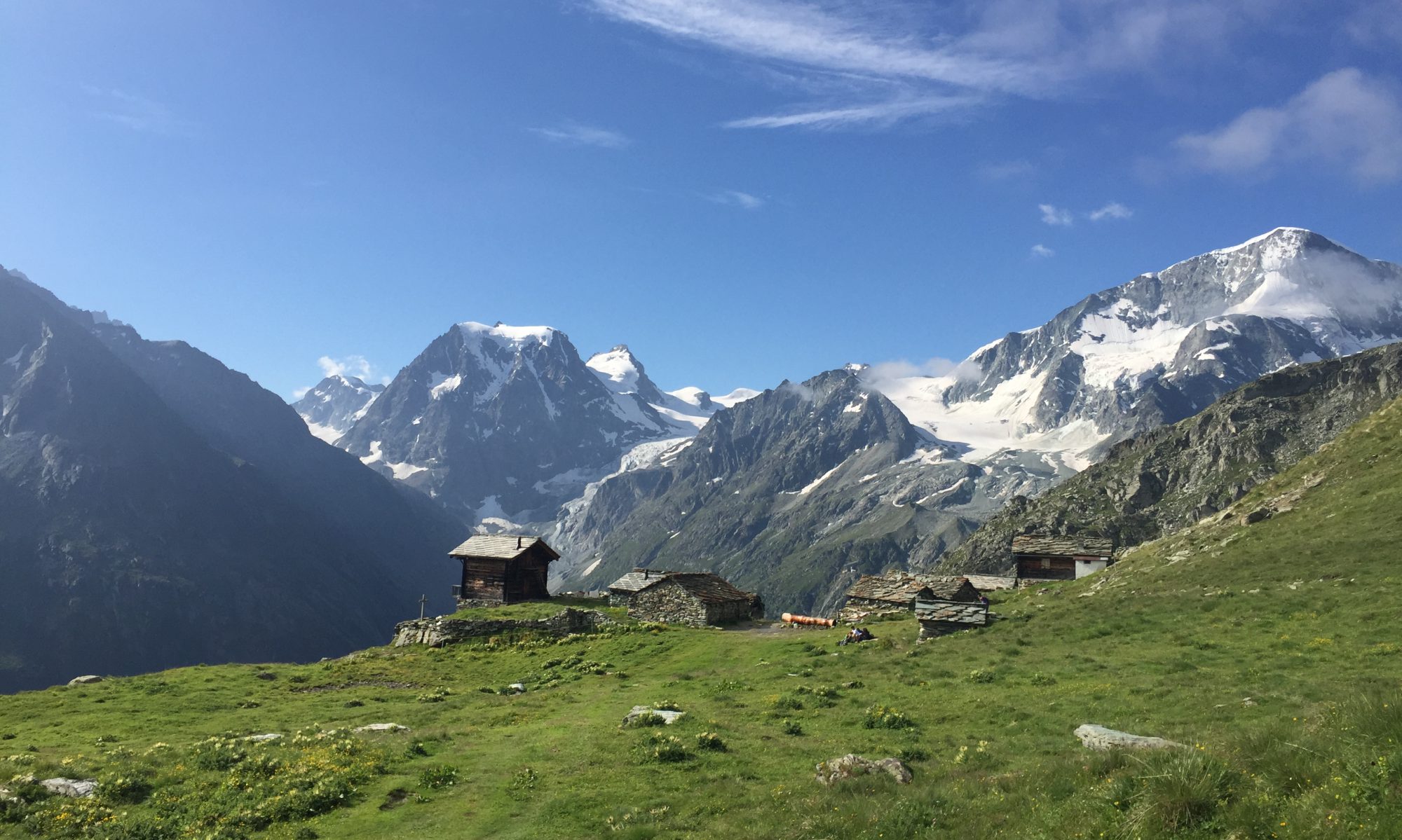
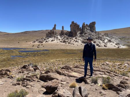
On another day we travelled by 4×4 for several hours on tracks through the desert, past salt flats, with no-one to be seen. We hiked up to over 4700m and came across a wetland, full of plants and birds. There were rock formations – Yardangs – cathedral towers several hundred meters high creating surreal monuments in the landscape. Rock art showed that we were not the first ones to visit.
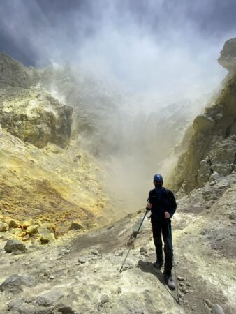
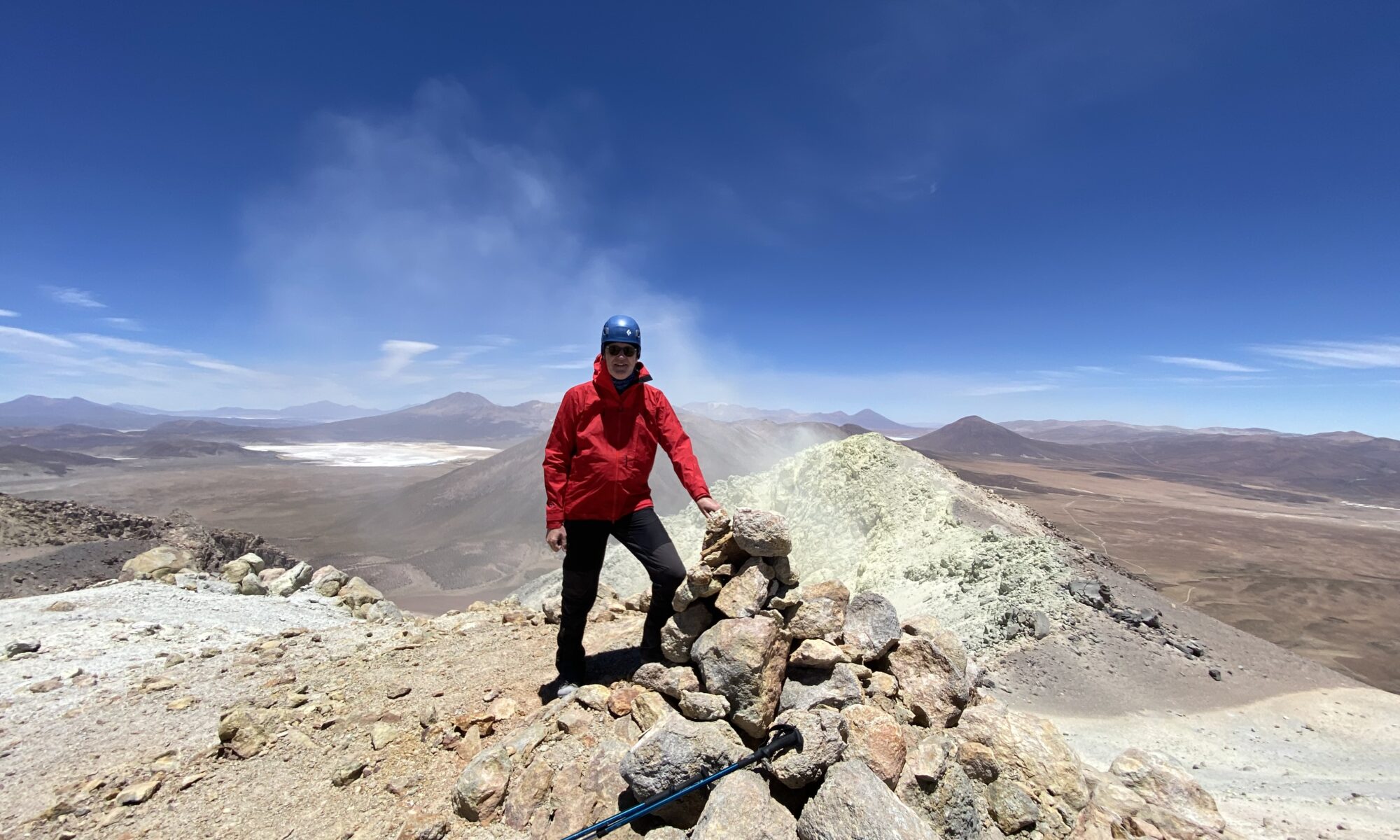
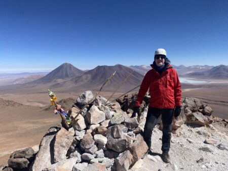
I climbed three volcanoes – Cerro Toco in Chile (5604m), Irruputuncu on the border of Bolivia and Chile (5163m) and Tunupa in Bolivia (5432m). Irruputuncu is active (and constantly monitored by sensors) and we went down into the caldera to experience (briefly) the fumaroles.
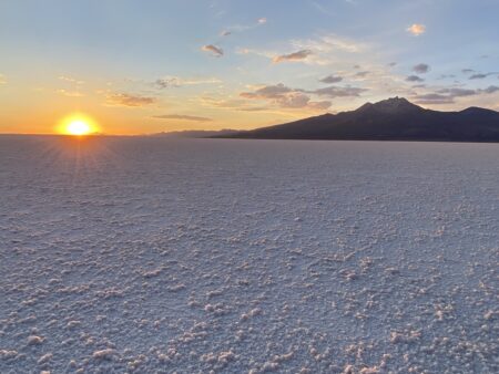
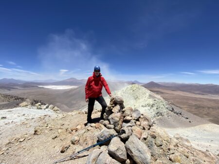
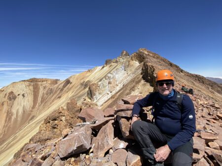
Tunupa overlooks the Uyuni Salt Flats, which gives it a commanding presence in the landscape, and mesmerising views from the top. It lies outside the two main Andean ranges and so is apart from other volcanoes, creating a geological oddity. The Tiwanaku people and modern day local indigenous people have their own explanation as to why it is there. It is a sacred mountain and we had an additional local guide who took us up to just below the summit and as high as is safe to climb. We all paid respects to Pacha Mama and had moments of reflection both at the base and at the top.
Making Sense of It All
My last day of the trip I just sat and looked at the view across the Uyuni Salt Flats. I’d had enough exploration. I just wanted to absorb the trip and what I had experienced. Late in the afternoon we went down onto the salt to have a little apéro, to watch the sun go down and the darkness rise.
A year on, and I was recently in a bookshop and delighted to find a book “Devil in the Mountain” – A Search for the Origin of the Andes, by Simon Lamb. It provides insights into Bolivian geology, which is bit niche I admit, but I am looking forward to reading it to try and understand better the formation of the altiplano. That said, I fully expect a more prosaic explanation to the local story of how Volcan Tunupa and the Salar de Uyuni come to be there.